
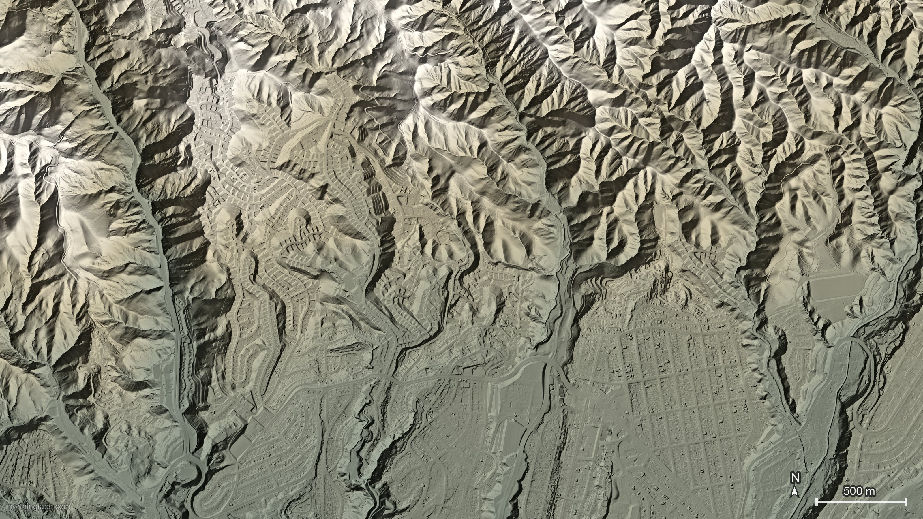
This is an evergreen piece, not news. Nothing new in 3DEP over the last couple of weeks made a better story for people who design on terrain data, so this one is about a file that's been around for years. For background, USGS posted a 17-minute training video on it on 25 August, Lesson 10.1, and its user engagement office promoted it again on 18 September. The file is WESM, the Work Unit Extent Spatial Metadata for the 3D Elevation Program. It's probably the most useful 3DEP file that most people who pull DEMs into Civil 3D have never opened. So I queried it for one spot in Pacific Palisades.
It came back with four lidar work units stacked on the same point, flown between 2015 and 2025, in two different coordinate systems, and one of them is flagged as not meeting 3DEP requirements at all. That's the takeaway. Before you build a surface from a free 3DEP DEM or LAZ tiles, look your site up in WESM and write down which work unit, which date and which datum you're actually designing on.
What's in the file
WESM lives on the 3DEP Spatial Metadata page. It comes as a GeoPackage and as a CSV table, and USGS says "a new WESM is written almost daily as more lidar projects are processed and published." Each record is a work unit, and for each product (the point cloud, the source DEM, the 1 m DEM and the seamless DEMs) it carries a status. In USGS's words that status says whether the product "meets 3DEP requirements, meets the requirements with variances, or does not meet 3DEP requirements", and each one comes with a category and a reason code.
The data dictionary is where it gets practical. There's collect_start and collect_end (the dates collection for that work unit started and ended), ql (the 3DEP quality level), spec (which lidar base specification it was flown under), horiz_crs and vert_crs as EPSG codes, geoid, and links straight to the work unit's metadata and point cloud folders.
Why a "single" DEM isn't one dataset
So here's the thing that catches people out. A 3DEP DEM downloaded from The National Map looks like one continuous grid. It isn't. USGS says plainly that the seamless 1 m product "is built from multiple lidar projects aligned to a common reference system." And a project is itself split into work units, which the data dictionary says happens "based on flight lines, differences in quality levels, or coordinate systems within a project or other factors."
That means the grid under your site can be a patchwork. One side of a ridge might come from a collection flown years before the other side. One might be QL2 and the other QL1. The same USGS product page notes that most data collected since 2014 meets QL2, while "data collected prior to 2014 often do not meet the quality level 2 specification." So if your site straddles a work-unit boundary, the surface you build can quietly put an older hillside right next to a newer one.
Most of the time that doesn't matter much. On stable, undeveloped ground a few years makes no difference. But if something has changed in between (a new subdivision, a landslide, a stockpile, a fire) you get a step or a seam in the surface, and it's really easy to blame your own survey or the coordinate system for it.
What WESM says about Pacific Palisades
Take the hills above Pacific Palisades in Los Angeles. NV5 flew the area in 2023 and 2024 for the USGS 3DEP partnership with the Los Angeles Region Imagery Acquisition Consortium (LARIAC). Then the Palisades Fire burned through in January 2025, and NV5 flew the burn zones again, on 21 January for the Palisades area. NV5 says the burn zones were flown at 16 points per square metre, and USGS released 0.5 m DEMs and DSMs to the public.
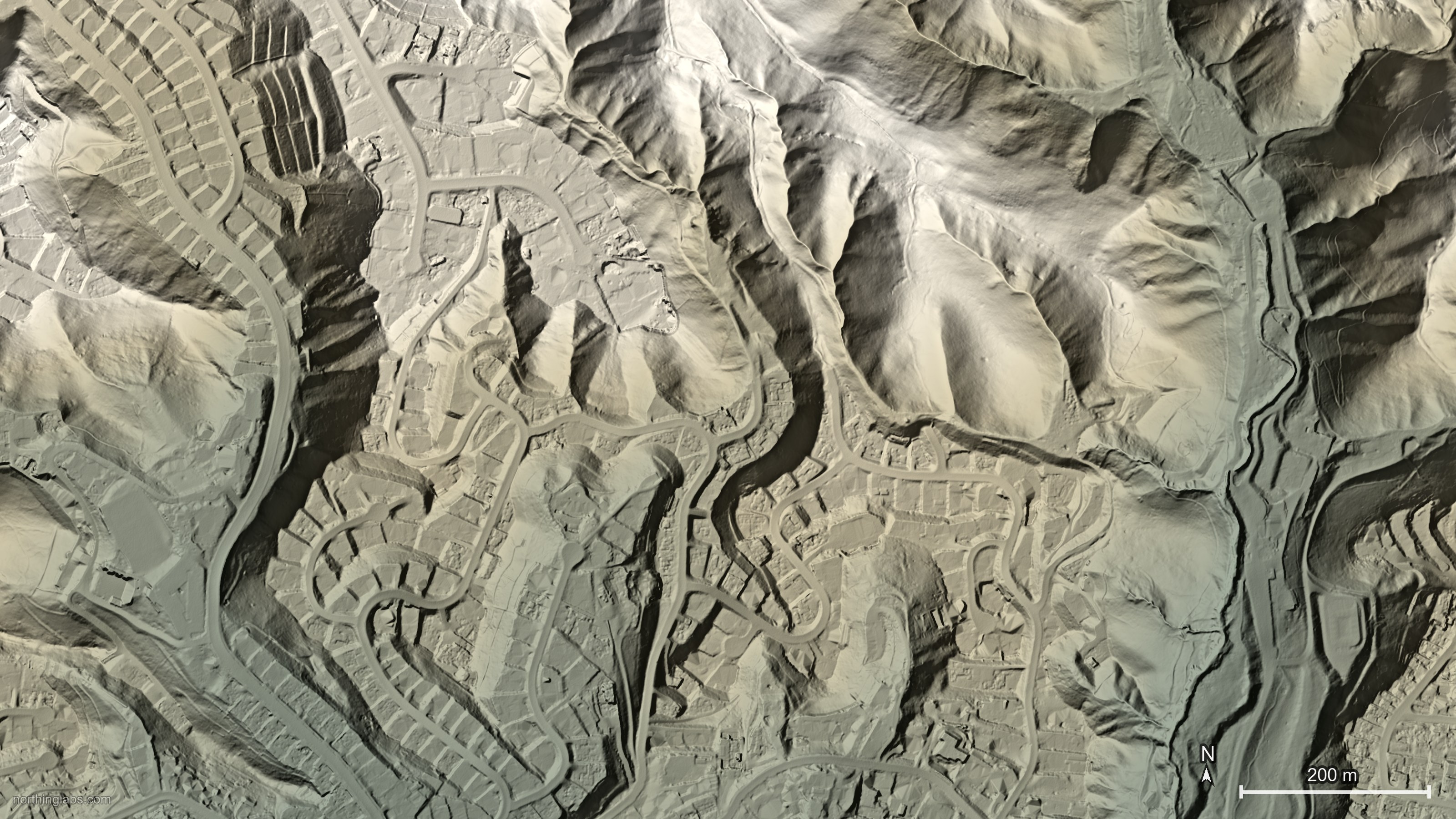
The WESM work-unit layer can be queried by point through The National Map's 3DEP elevation index, so I gave it 34.05 N, 118.53 W, on the hillsides above the Palisades, and asked for every lidar work unit touching it. Four came back.
| Work unit | Flown | QL, spec | Horiz / vert EPSG, geoid | Status (all products) |
|---|---|---|---|---|
| CA_LosAngeles_2016 | 27 Sep 2015 to 18 Oct 2016 | QL2, Base Spec 1.2 | 2229 / 6360, Geoid12B | Meets |
| CA_LosAngeles_1_B23 | 8 Jan 2023 to 7 Jan 2024 | QL1, 2023 Rev A | 6340 / 5703, Geoid18 | Meets |
| CA_2025FireImpactZonePalisades_PRELIMINARY_C25 | 21 Jan 2025 | "Other", "Other" | 6340 / 5703, Geoid18 | Does not meet, "Unvalidated dataset" |
| CA_LAPostWildfire_Palisades_C25 (300865) | 21 Jan 2025 | QL1, 2024 Rev A | 6340 / 5703, Geoid18 | Meets |
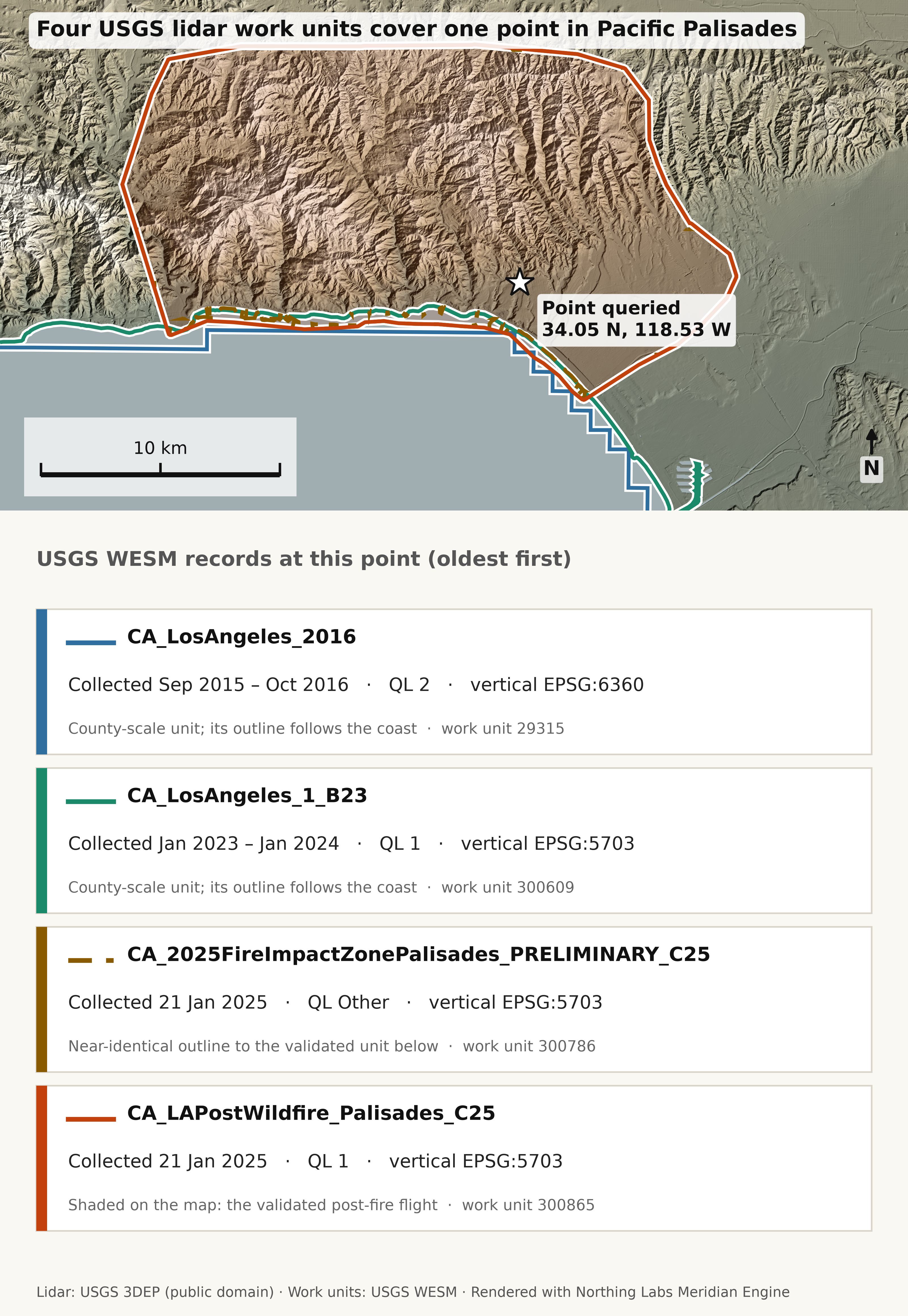
A few things jump out. The first is that the preliminary release is in there. It's the same 21 January flight, but WESM files it as its own work unit with quality level "Other", no point cloud ("LPC not available") and every product marked "Does not meet" with the reason "Unvalidated dataset". Its source DEM was published on 30 January 2025. The validated version, work unit 300865, didn't get its point cloud and source DEM published until 15 September 2025. So going by WESM's own dates, for about seven and a half months the only post-fire ground you could pull from 3DEP was the one USGS itself marks as not meeting spec. That's not a criticism, it was put out fast for debris-flow and flood work, which is what it was for. But if you built a surface from it last year, it's worth checking whether you ever swapped it for the final one.
The second is the 2016 unit. It's recorded as EPSG 2229, which is California State Plane zone 5 in US survey feet, with NAVD88 heights in feet on Geoid12B. The three newer units are UTM zone 11N in metres on Geoid18. So if you grab LAZ tiles from both vintages you're mixing units and geoid models, not just dates. (The 2023–24 unit is, I think, the LARIAC flight NV5 describes, since the dates line up.)
The third is that the 1 m DEM doesn't make the choice obvious. The 3DEP elevation image service lists the same 1 m tile, x35y377, three times at that point, once each from CA_LosAngeles_2016, CA_LosAngeles_B23 and CA_2025LosAngelesPostWildfire_C25. It also returns a 1/9 arc-second layer from a 2007 canyon-fire project, and the seamless 1/3 and 1 arc-second grids, whose listed source dates run from 1947 to 2023. So that's five different vintages of ground at one point. Two of the 1 m tiles are the ground a year before the fire and the burned slopes as of 21 January 2025, and the tile names only differ by the project suffix. The service itself returned the post-fire value on top there. That's probably what you want for debris-flow work. For a grading plan on a lot that's since been cleared and rebuilt, maybe not, and either way the next flight will be different again.
Then there's the seam. The NOAA catalogue record puts the post-fire unit at about 104 square miles, i.e. the burn area, not the county. Step off its edge and the newest validated ground probably drops back to the 2023–24 flight. So a site on the fringe of the burn can have a line through it where the ground date jumps back a year or more, and the WESM polygon shows you exactly where that line is.
What to do with it
It's not much work. Intersect the WESM GeoPackage (or that point query) with your site, read off the dates, QL, CRS and geoid, and put them in the Civil 3D surface description, something like "3DEP 1 m DEM, WU 300865 CA_LAPostWildfire_Palisades_C25, flown 21 Jan 2025, QL1, UTM 11N / NAVD88 m, Geoid18". If more than one validated unit touches the site you know there's a seam, and roughly where. Whoever opens the drawing in two years will thank you. And if your drawing is in state plane feet and the source is UTM metres, you find out before the surface comes in 3.28 times too high or too low, or miles off to one side, not after.
What WESM won't tell you
It tells you about the collection, not about your site. A work unit that meets QL1 on average can still have a bad patch under dense brush or on a steep face, and the NOAA record's own numbers for the post-fire unit show vegetated accuracy is a lot looser than open ground (29.72 cm at the 95th percentile vs. 3.67 cm RMSE in non-vegetated areas). So you still check the surface against your own shots. WESM just tells you what to expect going in.
And "meets with variance" is a category, not an explanation. The reason codes are listed per product, for the point cloud, the source DEM and the 1 m and seamless DEMs. For the 1 m DEM, for example, one variance reason is "LPC NPS <2ppsm and >1ppsm", so basically the point density came in between 1 and 2 points per square metre. That might not matter to you. It might. If your site sits in one of those units I'd read the project report before assuming.
Last thing: WESM is updated almost daily, so a check you did a while ago can be out of date. At Palisades, going by the publication dates, a check in spring 2025 would only have found the unvalidated post-fire release. If the site is somewhere that's changing (like a burn scar) just check again before you rebuild.
None of this is new data. It's a metadata file that's been sitting next to the DEMs for years. But one query answers "how old is this ground, how good is it, and what datum is it on", which is basically the first thing you'd want to know before designing on it.
Northing Labs is building tools to bring public terrain data into CAD. Coming soon, join the list to hear when it launches.
Sources
- USGS: Lesson 10.1 Spatial Metadata for 3DEP (video, 25 Aug 2026)
- USGS NGP User Engagement Office: New training video, Lesson 10.1 Spatial Metadata for 3DEP (18 Sept 2026)
- USGS: 3DEP Spatial Metadata (WESM downloads)
- USGS: WESM Data Dictionary, General Attributes
- USGS: WESM Data Dictionary, Product Status Code Categories
- USGS: WESM Data Dictionary, Reason Codes: Lidar Point Cloud
- USGS: WESM Data Dictionary, Reason Codes: Source DEM
- USGS: WESM Data Dictionary, Reason Codes: 1m and Seamless
- USGS 3DEP Elevation Index: lidar work-unit query at 34.05 N, 118.53 W
- USGS 3DEP Elevation image service: identify at 34.05 N, 118.53 W
- USGS: About 3DEP Products & Services
- USGS: 2025 Post-Wildfire Lidar Data for Los Angeles, CA
- NV5: NV5 and USGS release high resolution lidar data of Palisades Fire and Eaton Fire burn areas
- NOAA InPort: 2025 USGS Lidar DEM, Los Angeles Post-Wildfire, CA
- USGS 3D Elevation Program
- USGS: Copyrights and Credits